- 9 Aug 2023
Transforming Consultancies with Sustainable Solutions
In this blog, we’ll explore the potential of Geographic Information Systems (GIS) and how consultancies, like Urban Green, are utilising the technology to drive solutions across design and environmental disciplines.
What is GIS?
A GIS stores, manages, and processes spatial data and utilises this information to create, analyse and map a variety of different types of data. Using integrated spatial and descriptive data, such as maps, satellite imagery, and demographic information, GIS can identify patterns, understand relationships between geographic features, and uncover hidden trends, which is applicable to a wide variety of disciplines and uses, and as a result can improve management and decision making.
One of the remarkable aspects of GIS is its user-friendly nature. Thanks to advancements in technology and intuitive software interfaces, individuals from various backgrounds and expertise can quickly grasp the fundamentals of GIS. Intuitive tools and workflows enable users to navigate through data layers, perform analyses, and create interactive maps without requiring extensive technical skills. Furthermore, online GIS platforms and cloud-based solutions enable users to access applications readily from anywhere with an internet connection. This allows individuals across industries and sectors to leverage spatial data and make informed decisions quickly and with confidence.
Which Departments in Urban Green use GIS?
Arboriculture
GIS are vital in the delivery of arboriculture, managing and analysing spatial data related to trees and vegetation in particular with regards to Health and Safety and asset management in the creation of Visual Tree Assessments (VTAs). This involves the systematic inspection and evaluation of trees, assessing their health, stability, and potential risks. GIS enables our arboricultural consultants to collect and record VTA data in a spatial database, integrating attributes such as tree species, height, condition, and maintenance history. Through GIS, it enables the team to visualise and analyse this information spatially, identifying trends and areas of concern more effectively to immediately share with clients.
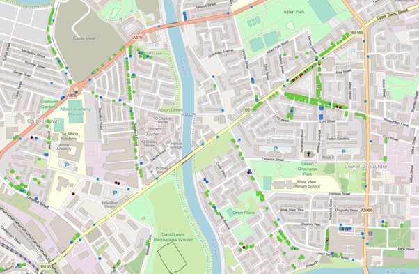 Street Tree Map produced
In the same way GIS is instrumental in the efficient production of BS5837 reports. These are necessary for planning applications with considerations and measures to protect and preserve trees form part of development proposals. GIS is utilised to accurately map existing trees, calculate root protection areas and define constraints. This spatial representation helps stakeholders visualise the impact of development on the surrounding treescape and make informed decisions with regards to impact on trees.
Moreover, GIS technology enables the creation of ArcGIS web maps, which are interactive and user-friendly platforms for sharing arboriculture outputs with stakeholders. These web maps provide an intuitive interface for users to explore and query tree data, view reports, and access documentation. This approach enhances communication and collaboration with clients, contractors, and regulatory authorities, fostering a more informed and transparent decision-making process in the management and preservation of trees.
Landscape Planning
Landscape and Visual Impact Assessments (LVIAs) evaluate the landscape and visual impact of proposed development projects on the surrounding environment, required as part of planning applications. GISs are utilised to enhance the accuracy and efficiency of these assessments integrating spatial data such as land use, topography, and vegetation cover, and enable the landscape planner to create detailed visual simulations and viewshed analyses. These simulations provide a realistic representation of how the proposed development will visually interact with the landscape, helping stakeholders understand and evaluate the potential impacts.
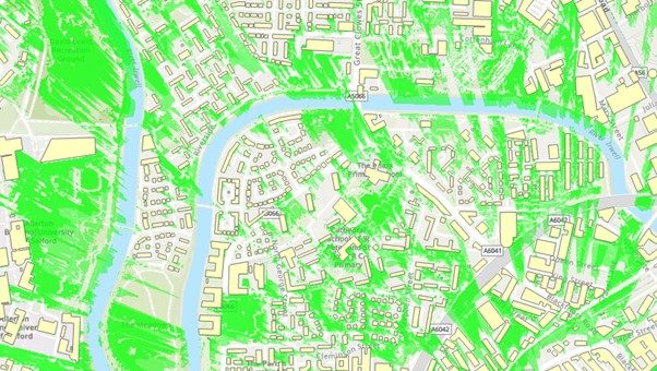 Zone of Theoretical Visibility Map showing street visibility
GIS also allows for the incorporation of additional factors like lighting, shadowing, and view corridors into the assessment process. Enabling ease of use and informed decisions, ensuring that development impacts are assessed and mitigated within the natural and built environment.
Ecology
Ecologists provide expertise in studying and understanding ecosystems, conducting surveys, and assessing habitats. They collect field data on species distribution, vegetation types, and ecological features. Through GISs they are able to process, analyse and visualise ecological data spatially.
UKHAB (UK Habitat Classification) system is used by our ecologists to categorise and classify habitats based on their characteristics and ecological significance. Using GIS software, accurate and comprehensive habitat maps are created, integrating spatial layers, such as topography, land cover, and species distribution. These provide valuable insights into the distribution, connectivity, and conservation status of different habitats. These maps form an essential element of Preliminary Ecological Appraisal’s (PEAs), habitat management planning and the implementation of conservation strategies.
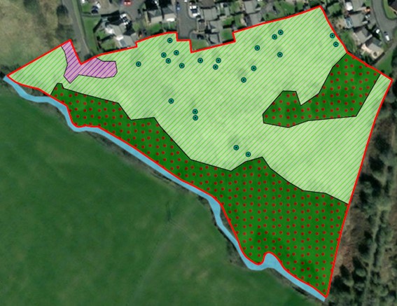 UKHAB Habitat Map using the given symbology
Biodiversity Net Gain
The Environment Bill sets out the requirement to achieve a Biodiversity Net Gain (BNG) of 10% for development sites. This will become mandatory for all planning applications from November 2023, effectively meaning that developers are required to leave the site in a better condition post development in relation to biodiversity.
GIS plays a vital role in establishing this emerging requirement, integrating, and analysing spatial data related to biodiversity, habitats, and ecosystems. BNG consultants identify areas of high ecological value, assess the potential impacts of development projects on biodiversity, and design strategies to enhance and protect wildlife habitats. GIS also facilitates the monitoring and evaluation of BNG outcomes over time, ensuring that the set goals are met. It can also be used to provide a biodiversity value in terms of low and high within the BNG metric and identify whether it can be marketed to developers as habitat banks or to make their own biodiversity improvements.
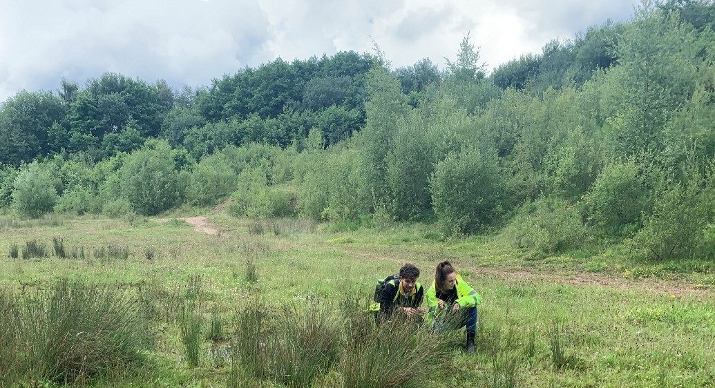 Consultants identifying species composition of a wet grassland
As demonstrated GIS is a fundamental tool that underpins the delivery of our technical services, ensuring efficient and effective consultancy with analytic and visual spatial data readily accessible for clients. It is constantly evolving with technology and available data so will always remain a ‘watch this space…..’